Regular readers of our now quite irregularly appearing blog will may remember we took a trip to India in December of 2015 and wrote an epic
19 part series of blog posts about it - this is not that trip. This is another trip, also to India, but this time mostly for a wedding instead of tourism. This is also Part 7, so you may wish to scroll down to Parts 1-6 if you haven't already read them.
As usual, the photos that we took can be found on
Flickr. Some of the photos used in this blog post were taken by friends of ours or the wedding photographers and don't appear on Flickr. Those will be noted with credit when used.
Day 6 Event 2: The Actual Wedding Reception
This was the fanciest wedding reception that I have ever been to, bordering on the surreal. Ana was not feeling well and stayed at the Club. When the foreigners took a bus over from the club, it appeared that an entire swanky hotel had been booked out for the event - if there were other guests in the rooms above, they were going to be thoroughly inconvenienced by the wedding, which occupied the entire main entrance.

First entrance - taking up the main entrance of the hotel

Second entrance past the first - these are not fake flowers
Seating for several hundred people in this room alone - it keeps going to either side and there is a balcony with more seating above (there were two more attached rooms nearby)
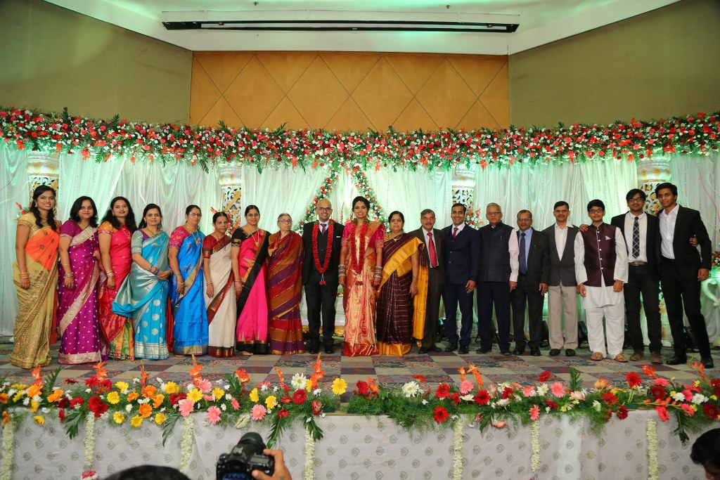
At the beginning of the event, members of the family (but not the bride and groom themselves) greeted all the guests. By this point in the wedding the whole family knows us and we know them at least a little - better than most of the guests at any rate - so we were made particularly welcome.
As events got going, photographers deployed a large drone with camera on it inside the banquet hall. As it flew over tables, it would blow napkins and decorations around, which we thought was pretty funny. I admit that some folks at my table, including myself, deliberately made faces at the drone when the noise interfered with conversation and thereafter it appeared that the operator made a point of buzzing our table on each subsequent pass.
Unlike many other events, this one did not focus on prayers and the key elements appeared to us to be the bride and groom getting pictures with absolutely as many people as possible. Once they appeared, there was first an enormous on-stage photo shoot for them with all possible configurations of other family members that went on for quite a while.
After six days of wedding, the bride and groom were pretty much permanently fixed into 'smiling' faces - and this event was the final, grueling test
Fortunately, while this was going on, appetizers were made available and once again they were delicious. The little carts going around with appetizers were heavily trafficked so it was important to stock up when you got to the front of the line. My careful sampling determined that the green chicken appetizer that tasted a bit like jerk chicken was the optimal menu item and I pursued it all over the banquet floor as the endless photo shoots continued. I imagine the folks up on the stage would rather have been chasing appetizers as well.
That's the stuff - go for the green chicken!
Once the main photo shoot ended, the greeting of guests by the bride and groom began. Probably 95% of the people there got in line to get a picture at some point - they queued up ten people wide at the back of the line and the line didn't get any shorter for literally two or three hours because as soon as it did more people would get in line.
This went on FOR-EVER. Everyone wanted a special picture with the bride and groom, who were definitely looking the worse for wear towards the end of their fourth hour of smiling and posing.
An hour or so into the receiving line time, the actual dinner got served and I don't believe I have ever seen a buffet with more options. It was outside adjacent to the banquet hall, under a giant tent, the sides of which were entirely lined by different dishes. They did repeat on opposing sides of the tent, but were unique aside from that. I had been doing valiant battle with the appetizers for quite a while at this point, but the buffet looked so good that I went and got an enormous plate anyway.
I would say about half the tent is in this picture
Meanwhile, the line to get a picture with the couple continued. Most of the foreigners looked at the line, looked at the couple, and decided everyone involved would be better off if we didn't get in line, and we waited for the line to finally end, ate, and talked.
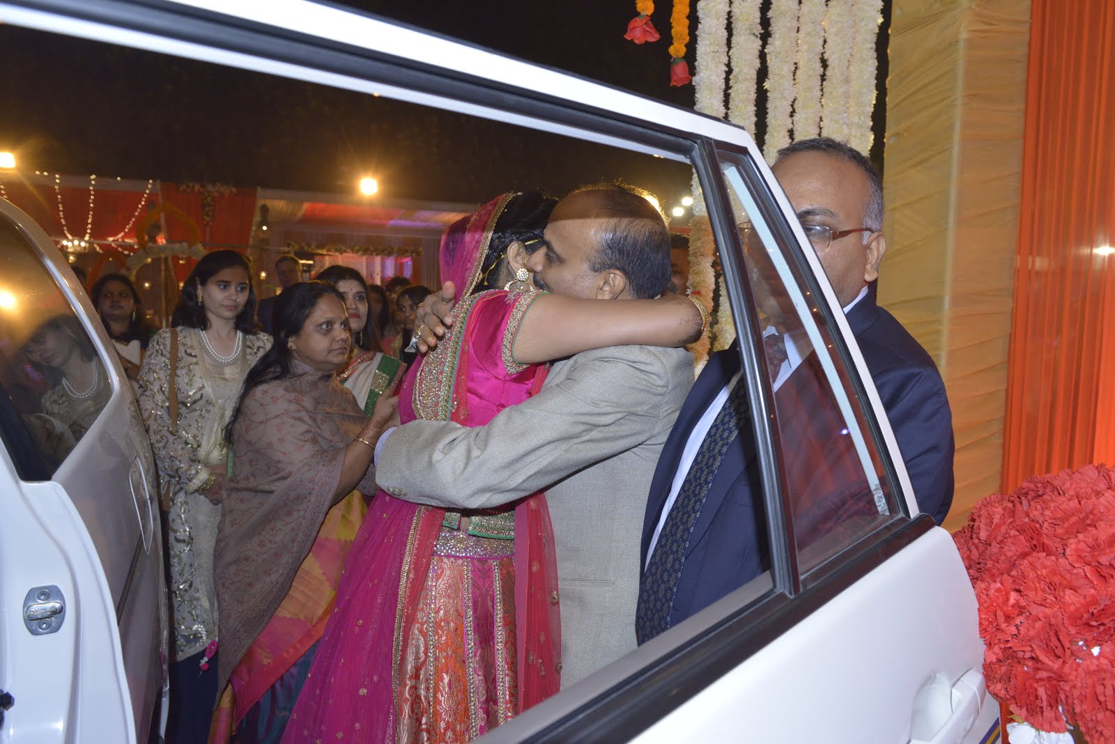
We were in this event for the long haul, waiting to see them off at the end
Finally, late into the night when the couple had shaken all the hands and taken all the pictures and left the stage, we went up as a group to see them. Someone went running to bring them plates from the buffet, and I believe our instructions to the couple were something along the lines of "Don't stand up, don't smile, and don't feel the need to say anything - keep eating." After they had some food we had a few minutes to talk - the bride would be nearly in tears when she said they'd watched us decide to not get in the photo line from up on the stage, knew it was in consideration of their fatigue, and "knew who our real friends were." I think we were all happy to have been there for them through the whole thing.
Of course, they couldn't escape the evening without a few more pictures on the way out...
This event closed the wedding and they actually got a few days to rest and relax on a honeymoon in Goa after the wedding. Several of our friends continued on to that leg of the trip, but we were needed at home to finish up the semester and get final grades in, so we headed out the next day for the long trip home. This was: club to Hyderabad airport, Hyderabad to Delhi, Delhi to London, London to Raleigh, plus the hour's drive home from there - leaving at around 4PM on the 13th and arriving around 5PM on the 14th...which sounds like 25 hours except that India is 10.5 hours ahead - closer to 35 hours in transit end to end.
Can't complain too much though - we are lucky to have such friends on any continent and we wouldn't have dreamed of missing their wedding. We caught up with some old friends and made some new ones, and overall had a darn good time.